Description
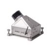
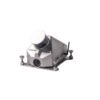
Lightweight Mobile Mapping System
Does LiMobile come with a point cloud post-processing tool?
We recommend using LiDAR360, a comprehensive point cloud post-processing suite developed by GreenValley International. LiDAR360 provides comprehensive toolsets for point cloud visualization, processing, analysis, and other tasks.
LiGeoreference software included
- Laser sensor: HESAI-XT32
- Measuring range: Up to 120 m
- Max. Effective Measurement Rate: 1,280,000 pts/sec
Included in package:
- 1x Protection for laser scanner
- 1x Battery charger and power cable
- 1x LiMobile main body
- 1x Push pull bracket
- 1x Surface tablet and accesoires
- 1x GNSS antenna
- 1x Ethernet cable (with USB adapter)
- 1x GNSS feeder cable
- 1x Battery compartment
- 1x Power supply cable


Reviews
There are no reviews yet.